The Goal
The Beach Bathing Water Quality Online Map,
is meant to reflect the values of the bacterial Sampling,
that is being sampeld often at all of the bathing beaches across Israel.
Its main users are surfers.
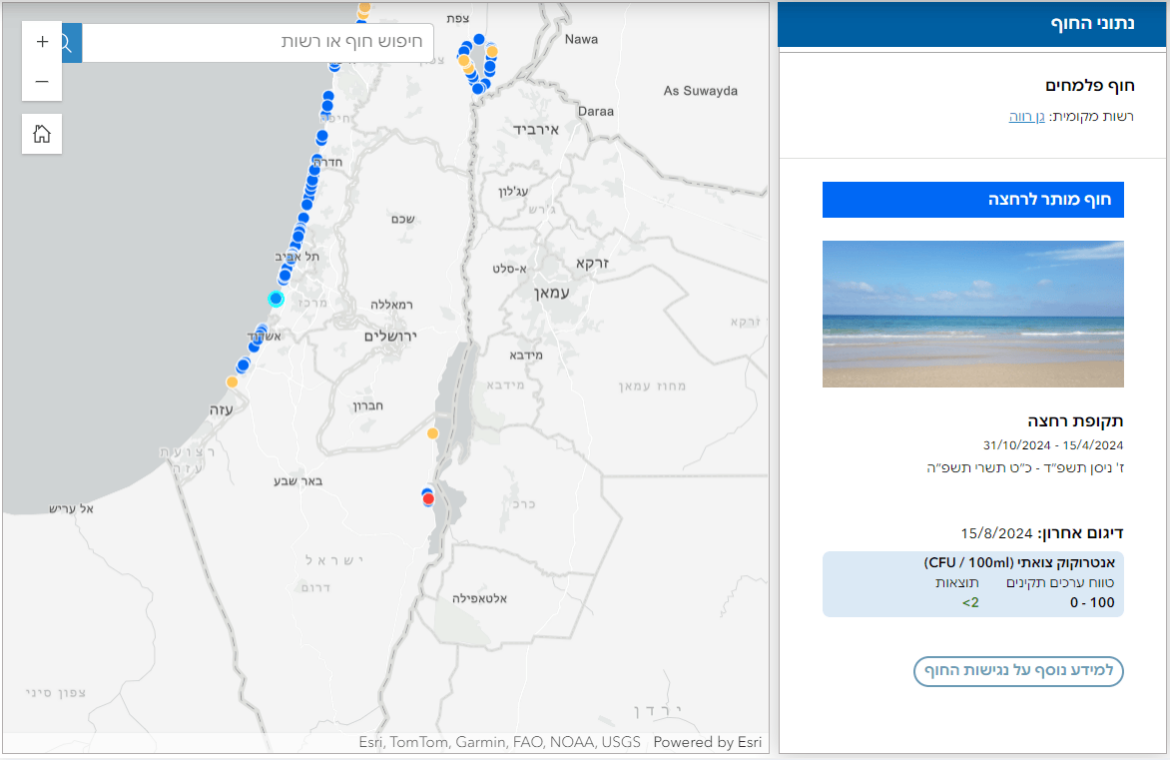
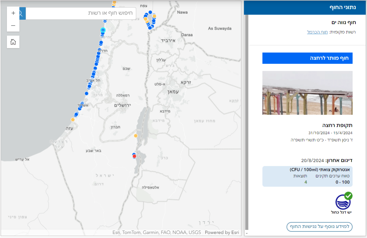
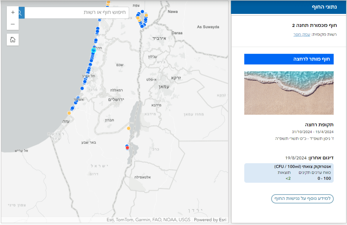
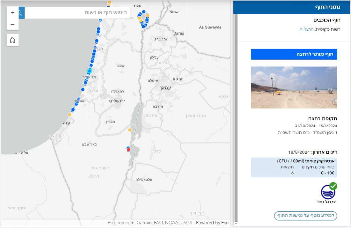
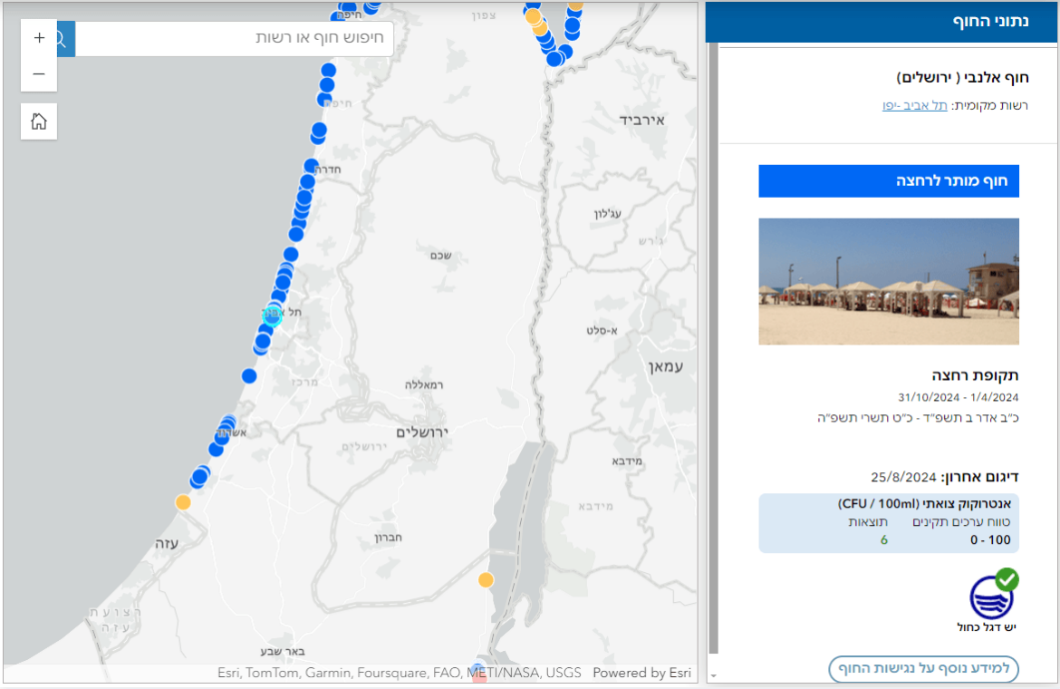
The information is presented on top of a GIS interactive map that shows all of the bathing beaches across Israel.
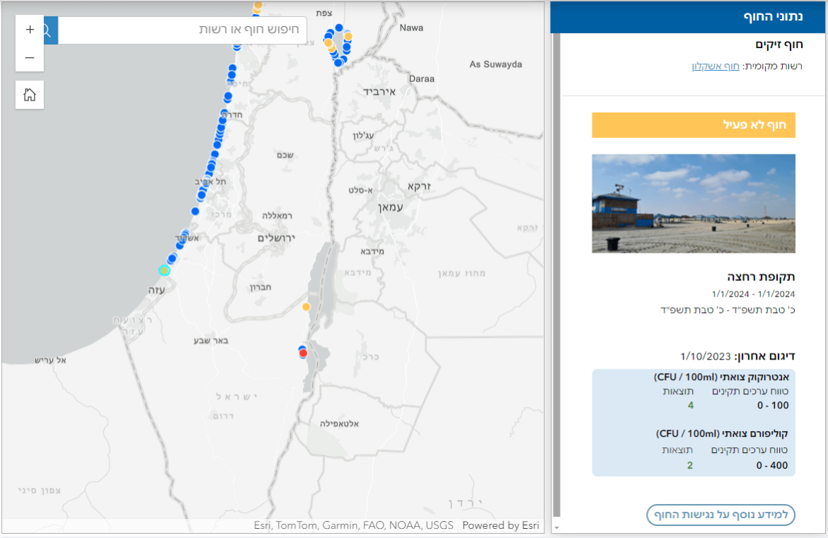
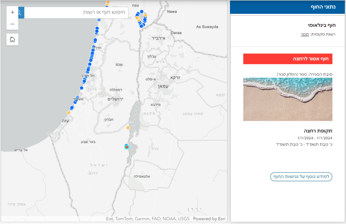
Every beach is represented by a dot that its color represents a status:
Open vs Close for swim beach.
A click on every beach will open a side bar that shows the values and details of the water quality at each beach.
Ux Visual Additions
Understanding there are plenty of bathing beaches in Israel,
In addition to creating the knowledge visual architecture and reflecting the requested values,
I offered to go on a campaign of represnting every beach with a picture of it,
so that the users will recognize the beach they want to get informed of,
after clicking it from the map.
The picture will appear and the user will know he is in the right place.
For this to happen, we sent some instructions for taking the picture of the beach
to every lifeguard that sits in the Beach Guardhouse,
then added the pics to the relevant Beach side bar in the GIS map.
For the beaches we didn’t get a picture for, we gave a general beach pic.
